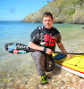
 A quick update from Jeff at noon today (5/15). They picked up a tidal current table yesterday and passed through Seymour Narrows on slack late yesterday afternoon. They felt a bit cheated due to the fact that it was totally calm (earlier in the day it was running at 14.6 knots against them). They got a good push from the tide up into Johnstone Strait. They are currently in Johnstone Strait about 47 miles SE of Port McNeill. They plan to push on and try to reach Port McNeill later today. Forecasts are for following winds and tide. I'll post a map of their location later this evening.
-- Jon
ps. Several people have asked about distances paddled. If you click on the map you will see a larger version with dots that indicate last known locations, with dates. At the bottom of the map there is a bar indicating 100 nautical miles. You can use this to get a fairly close approximation to the distances paddled each day. They are currently averaging around 35 nautical miles a day, nearly all against the wind, and some against the tide ... both factors somewhat self inflicted ;) By the time they get on the West coast they will finally get some SE winds, but by then they will be heading the opposite direction! Seriously, it does look like they could get some bad weather for a couple of days at least next weekend.
2 comments:
Amazing when you actually know which way the water is moving.
Kind of the "free solo" of kayaking. Paddleing without a current chart is like climbing without a rope, I guess.
the portland, oregon folks are hoping for a big day! shouldn't be too hard to hit 100 miles or so tommorow with big following seas and tide moving in the right direction (-:
of course, i'd be curled up on some rocky beach right now preparing to sleep for the next 48 hours.
this is cool...
Post a Comment